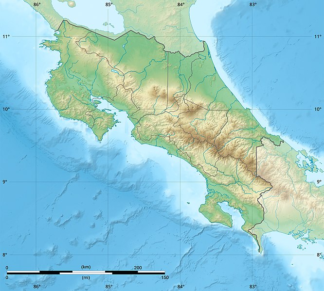
File:Costa Rica relief location map.jpg
外观

本预览的尺寸:666 × 600像素。 其他分辨率:267 × 240像素 | 533 × 480像素 | 853 × 768像素 | 1,148 × 1,034像素。
原始文件 (1,148 × 1,034像素,文件大小:841 KB,MIME类型:image/jpeg)
文件历史
点击某个日期/时间查看对应时刻的文件。
| 日期/时间 | 缩略图 | 大小 | 用户 | 备注 | |
|---|---|---|---|---|---|
| 当前 | 2022年3月30日 (三) 22:51 |  | 1,148 × 1,034(841 KB) | Sting | New map using new data |
| 2021年11月4日 (四) 01:32 |  | 1,148 × 1,034(906 KB) | RoboQwezt0x7CB | hand edited to remove non-existing waterbodies, used lower elevation green shade to bucket fill (best I can do without the tools to generate the map) particulary in the south of the country (probably an altitude render/clipping error), kept some that are hydroelectric plant's reservoirs | |
| 2010年7月19日 (一) 12:11 |  | 1,148 × 1,034(500 KB) | Sting | Color profile | |
| 2008年7月30日 (三) 15:05 |  | 1,148 × 1,034(491 KB) | Sting | - border | |
| 2008年6月13日 (五) 14:40 |  | 1,148 × 1,034(499 KB) | Sting | Several improvements | |
| 2008年6月12日 (四) 01:21 |  | 1,148 × 1,034(501 KB) | Sting | Correction on shaded layer | |
| 2008年6月12日 (四) 01:09 |  | 1,148 × 1,034(504 KB) | Sting | == Summary == {{Location|10|00|00|N|84|00|00|W|scale:2000000}} <br/> {{Information |Description={{en|Blank relief map of Costa Rica for geo-location purpose.<br/>''Note :'' The ''Isla del Coco'', out of the map, is not shown.<br/>Scale |
文件用途
以下11个页面使用本文件:
全域文件用途
以下其他wiki使用此文件:
- ar.wikipedia.org上的用途
- ast.wikipedia.org上的用途
- azb.wikipedia.org上的用途
- az.wikipedia.org上的用途
- ban.wikipedia.org上的用途
- ba.wikipedia.org上的用途
- be.wikipedia.org上的用途
- bg.wikipedia.org上的用途
- bn.wikipedia.org上的用途
- bs.wikipedia.org上的用途
- ca.wikipedia.org上的用途
- ceb.wikipedia.org上的用途
- ce.wikipedia.org上的用途
- ckb.wikipedia.org上的用途
- cs.wikipedia.org上的用途
查看此文件的更多全域用途。


