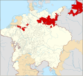
File:Locator Brandenburg-Prussia within the Holy Roman Empire (1618).svg
外观

此SVG文件的PNG预览的大小:658 × 600像素。 其他分辨率:263 × 240像素 | 527 × 480像素 | 843 × 768像素 | 1,123 × 1,024像素 | 2,247 × 2,048像素 | 2,769 × 2,524像素。
原始文件 (SVG文件,尺寸为2,769 × 2,524像素,文件大小:1,024 KB)
文件历史
点击某个日期/时间查看对应时刻的文件。
| 日期/时间 | 缩略图 | 大小 | 用户 | 备注 | |
|---|---|---|---|---|---|
| 当前 | 2015年1月28日 (三) 00:50 |  | 2,769 × 2,524(1,024 KB) | Sir Iain | Corrected Bohemian border |
| 2015年1月27日 (二) 14:20 |  | 2,769 × 2,524(1,014 KB) | Sir Iain | Redone Schleswig-Holstein | |
| 2015年1月5日 (一) 00:55 |  | 2,769 × 2,524(994 KB) | Sir Iain | Savoy shown as core territory of the HRR | |
| 2014年12月23日 (二) 20:28 |  | 2,769 × 2,524(994 KB) | Sir Iain | Removed the Imperial border between Germany and the Netherlands | |
| 2014年12月22日 (一) 14:56 |  | 2,769 × 2,524(999 KB) | Sir Iain | User created page with UploadWizard |
文件用途
以下页面使用本文件:
全域文件用途
以下其他wiki使用此文件:
- azb.wikipedia.org上的用途
- bg.wikipedia.org上的用途
- bxr.wikipedia.org上的用途
- cs.wikipedia.org上的用途
- de.wikipedia.org上的用途
- en.wikipedia.org上的用途
- en.wikibooks.org上的用途
- eo.wikipedia.org上的用途
- es.wikipedia.org上的用途
- fi.wikipedia.org上的用途
- fr.wikipedia.org上的用途
- he.wikipedia.org上的用途
- id.wikipedia.org上的用途
- it.wikipedia.org上的用途
- ja.wikipedia.org上的用途
- ko.wikipedia.org上的用途
- lv.wikipedia.org上的用途
- pl.wikipedia.org上的用途
- ru.wikipedia.org上的用途
- ru.wikiversity.org上的用途
- th.wikipedia.org上的用途
- tr.wikipedia.org上的用途
- ur.wikipedia.org上的用途
- vi.wikipedia.org上的用途
- vls.wikipedia.org上的用途

