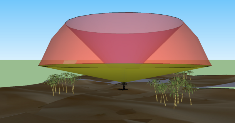
File:Radar coverage from ground level.png
外觀

預覽大小:800 × 419 像素。 其他解析度:320 × 168 像素 | 640 × 335 像素 | 958 × 502 像素。
原始檔案 (958 × 502 像素,檔案大小:203 KB,MIME 類型:image/png)
檔案歷史
點選日期/時間以檢視該時間的檔案版本。
| 日期/時間 | 縮圖 | 尺寸 | 用戶 | 備註 | |
|---|---|---|---|---|---|
| 目前 | 2010年8月10日 (二) 19:39 |  | 958 × 502(203 KB) | Maury Markowitz | {{Information |Description={{en|1=A simple 3D diagram (from Google Sketch) showing a representative radar coverage pattern. The rounded surface is the maximum range of the system (which may be "soft"), the lower limit is selected to avoid reflections from |
檔案用途
下列頁面有用到此檔案:
全域檔案使用狀況
以下其他 wiki 使用了這個檔案:
- en.wikipedia.org 的使用狀況
- es.wikipedia.org 的使用狀況
- et.wikipedia.org 的使用狀況
- fr.wikipedia.org 的使用狀況
- pt.wikipedia.org 的使用狀況
- ru.wikipedia.org 的使用狀況


