
File:Har Nuur, Mongolia.jpg
預覽大小:800 × 533 像素。 其他解析度:320 × 213 像素 | 640 × 427 像素 | 1,024 × 683 像素 | 1,280 × 853 像素 | 2,560 × 1,706 像素 | 3,311 × 2,207 像素。
原始檔案 (3,311 × 2,207 像素,檔案大小:4.04 MB,MIME 類型:image/jpeg)
摘要
| 描述 |
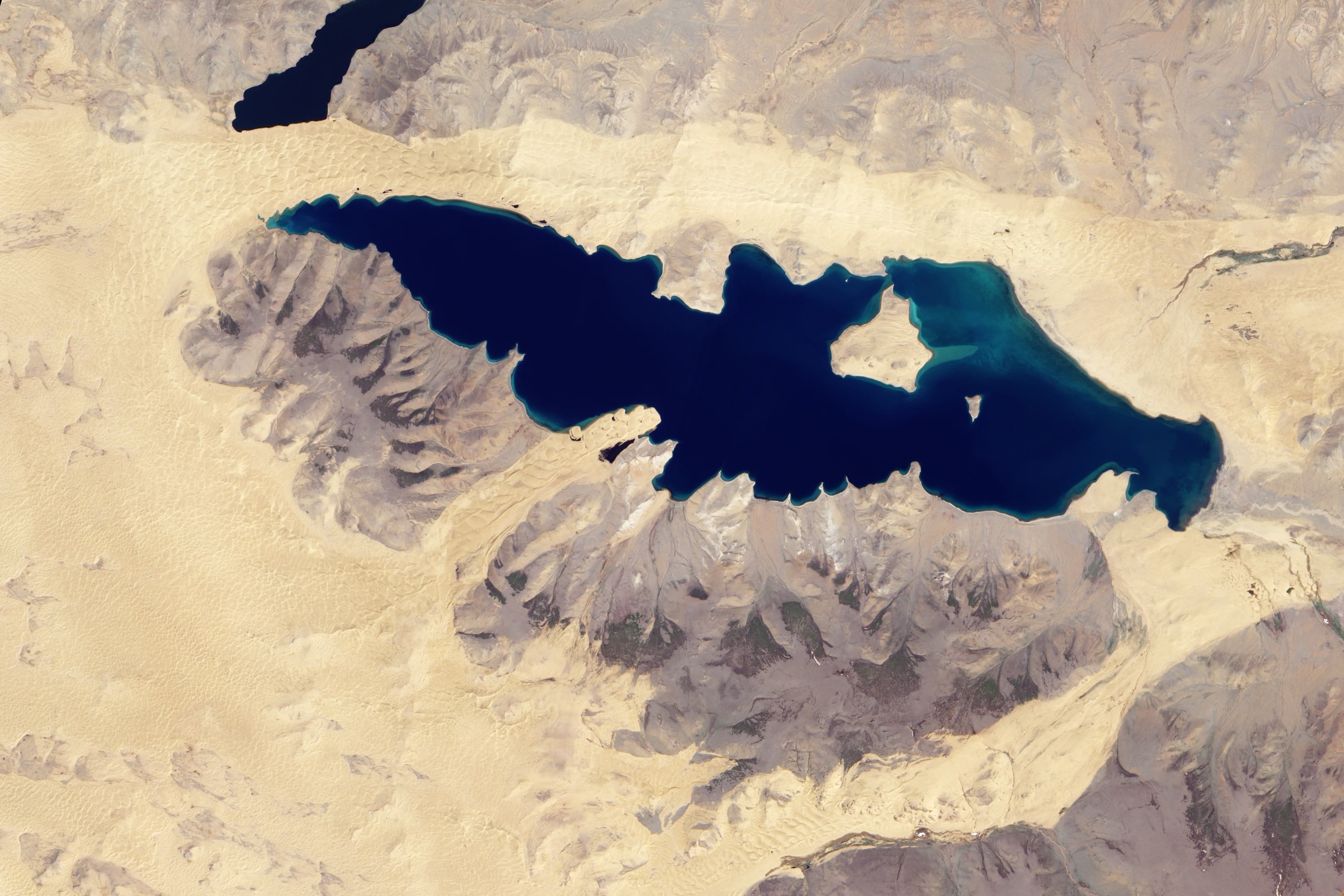
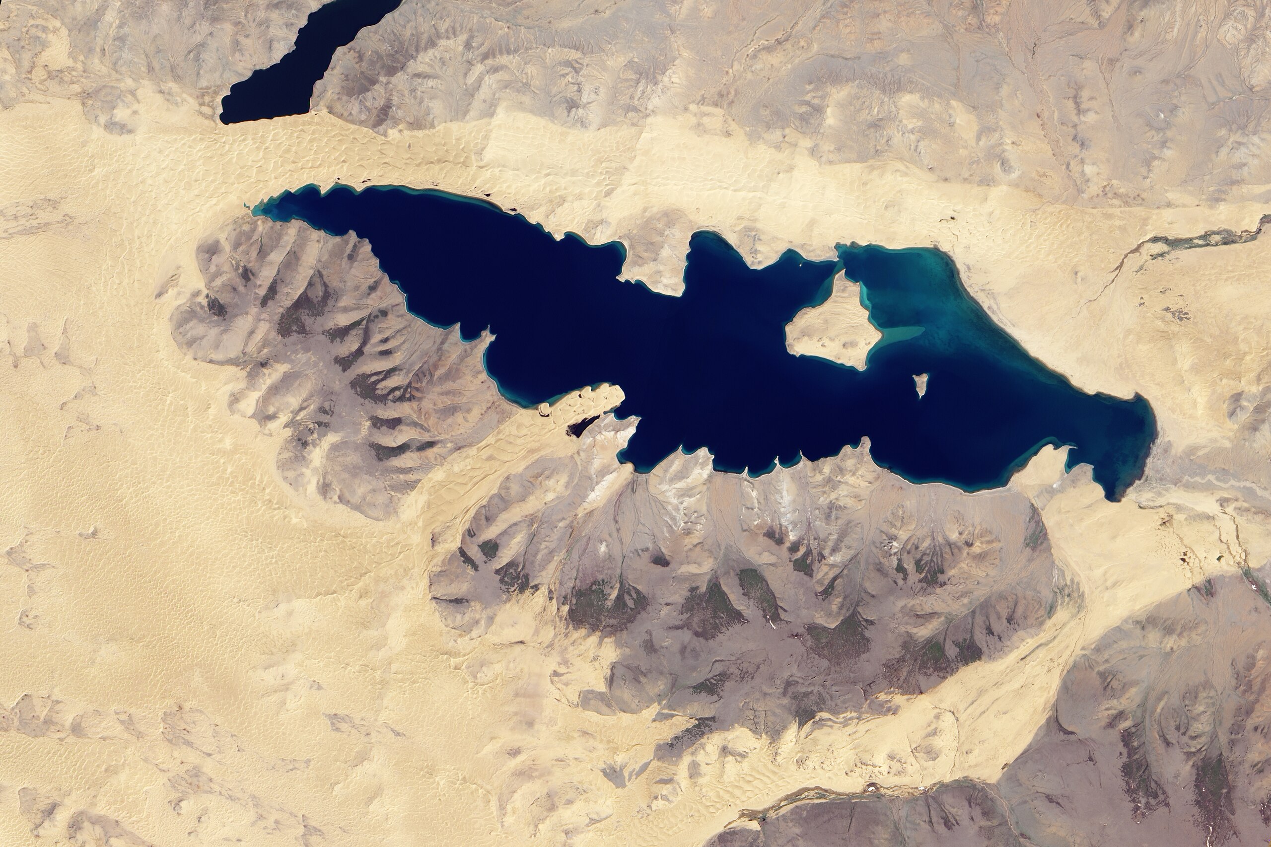
English: Natural-colour image of Har Nuur. Camel-coloured sand dunes ripple along the lake’s northern shore. Along the southern shore, sand dunes approach the lake in just two locations. A triangle-shaped expanse of sand borders Har Nuur in the east, and a tongue of sand intrudes into the lake in the west, pushing through a gap in the nearby mountains. All of the sane dunes, however, form part of a larger dune field nearly encircling the lake. |
| 日期 | |
| 來源 | NASA Earth Observatory |
| 作者 | Jesse Allen |
Image captured by the Advanced Land Imager (ALI) on NASA’s Earth Observing-1 (EO-1) satellite. EO-1 ALI data provided courtesy of the NASA EO-1 team.
授權條款
| 本作品由NASA創作,屬於公有領域。根據NASA的版權政策:“NASA的創作除非另有聲明否則不受版權保護。”(參見:Template:PD-USGov/zh,NASA版權政策或JPL圖像使用政策) | ||
 |
警告:
|
檔案歷史
點選日期/時間以檢視該時間的檔案版本。
| 日期/時間 | 縮圖 | 尺寸 | 用戶 | 備註 | |
|---|---|---|---|---|---|
| 目前 | 2010年6月28日 (一) 10:43 | | 3,311 × 2,207(4.04 MB) | Originalwana | {{Information |Description={{en|1=Natural-colour image of Har Nuur. Camel-coloured sand dunes ripple along the lake’s northern shore. Along the southern shore, sand dunes approach the lake in just two locations. A [[:Category:T |
檔案用途
下列頁面有用到此檔案:
全域檔案使用狀況
以下其他 wiki 使用了這個檔案:
- en.wikipedia.org 的使用狀況
- es.wikipedia.org 的使用狀況