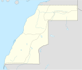
File:Western Sahara location map.svg
外觀

此 SVG 檔案的 PNG 預覽的大小:677 × 600 像素。 其他解析度:271 × 240 像素 | 542 × 480 像素 | 867 × 768 像素 | 1,156 × 1,024 像素 | 2,312 × 2,048 像素 | 1,472 × 1,304 像素。
原始檔案 (SVG 檔案,表面大小:1,472 × 1,304 像素,檔案大小:160 KB)
檔案歷史
點選日期/時間以檢視該時間的檔案版本。
| 日期/時間 | 縮圖 | 尺寸 | 用戶 | 備註 | |
|---|---|---|---|---|---|
| 目前 | 2020年12月26日 (六) 00:31 |  | 1,472 × 1,304(160 KB) | M.Bitton | Reverted to version as of 21:14, 27 December 2016 (UTC) |
| 2020年12月25日 (五) 03:45 |  | 1,155 × 1,023(139 KB) | EdDakhla | npov, new source https://www.usnews.com/news/world/articles/2020-11-17/morocco-pm-says-western-sahara-wall-at-centre-of-dispute-completed | |
| 2016年12月27日 (二) 21:14 |  | 1,472 × 1,304(160 KB) | Gajmar | 2015 divisions (OSM data) | |
| 2009年11月22日 (日) 12:40 |  | 1,472 × 1,304(161 KB) | NordNordWest | ||
| 2009年11月22日 (日) 12:39 |  | 1,472 × 1,305(161 KB) | NordNordWest | ||
| 2009年4月2日 (四) 08:53 |  | 1,539 × 1,304(158 KB) | NordNordWest | corr | |
| 2009年4月2日 (四) 08:46 |  | 1,539 × 1,304(158 KB) | NordNordWest | {{Information |Description= {{de|Positionskarte der Westsahara}} Quadratische Plattkarte, N-S-Streckung 105 %. Geographische Begrenzung der Karte: * N: 28.2° N * S: 20.7° N * W: 17.5° W * O: 8.2° W {{en|Location map of [[:en:Western |
檔案用途
下列13個頁面有用到此檔案:
全域檔案使用狀況
以下其他 wiki 使用了這個檔案:
- af.wikipedia.org 的使用狀況
- am.wikipedia.org 的使用狀況
- an.wikipedia.org 的使用狀況
- ar.wikipedia.org 的使用狀況
- arz.wikipedia.org 的使用狀況
- be-tarask.wikipedia.org 的使用狀況
- be.wikipedia.org 的使用狀況
- bg.wikipedia.org 的使用狀況
- ceb.wikipedia.org 的使用狀況
- Plantilya:Location map Western Sahara
- Punta Gorda
- Peña Grande
- Pan de Azucar
- Sugarloaf
- Punta Negra
- Mancha Blanca
- Lash
- Puerto Rico (pagklaro)
- Canal Principal
- Río de Oro
- Punta Norte
- Punta Blanca
- Puerto Nuevo
- Virgin Rock
- Punta Sur
- Mesa Negra
- El Rincón
- Pointe Noire
- Pan de Azúcar
- Las Ballenas
- Oued el Hamira
- Guelta
- El Bir
- Daoura
- Dakhla
- Guera
- Los Lobos
- Punta Galera
- Choum
- Tierra Alta
- Cape Blanco
- Punta de los Roques
- Garnet Bay
檢視此檔案的更多全域使用狀況。


