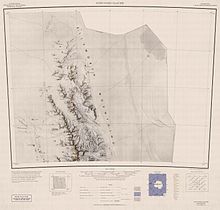
米勒海崖
外观


77°35′S 85°45′W / 77.583°S 85.750°W
米勒海崖(英語:Miller Bluffs),是南極洲的海崖,位於埃爾斯沃思地,屬於埃爾斯沃思山脈中森蒂納爾嶺的一部分,長28公里,在1935年11月23日由美國探險隊拍攝照片,現時由南極條約體系管理。
參考資料
[编辑]Miller Bluffs. Geographic Names Information System. United States Geological Survey. [2013-09-25].
| 这是一篇埃爾斯沃思地地理小作品。您可以通过编辑或修订扩充其内容。 |
